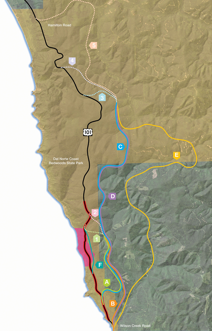
Preliminary Alternatives
Choose an alternative below:
Alternatives in gray have been excluded from further study.
- ALL
- EA
- A1
- A2
- B1
- B2
- C3
- C4
- C5
- D3
- D4
- D5
- E3
- E4
- E5
- F
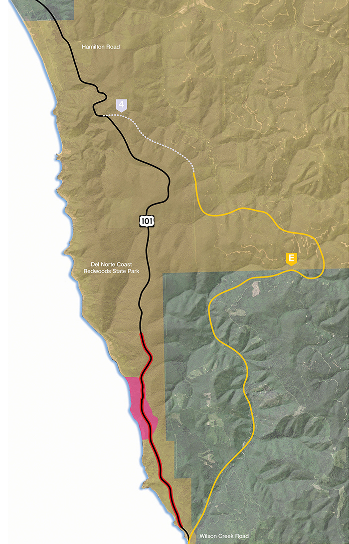
ALL
Last Chance Grade Preliminary Alternatives
The Last Chance Grade Feasibility Study has identified a number of possible alternatives to the existing highway. These alternatives are in the preliminary phase; following publication of the Final Feasibility Study, they will be further analyzed and refined.
Please note the following:
- Lines on the map indicate the width of each corridor, not the exact placement of the roadway.
- The acreages of “Existing Habitat Type” are estimates based on overall analyses of habitat types in the area.
- Costs are estimated and include construction, materials disposal and mitigation.
Use the buttons above to select an alternative and find out more information about each of them.
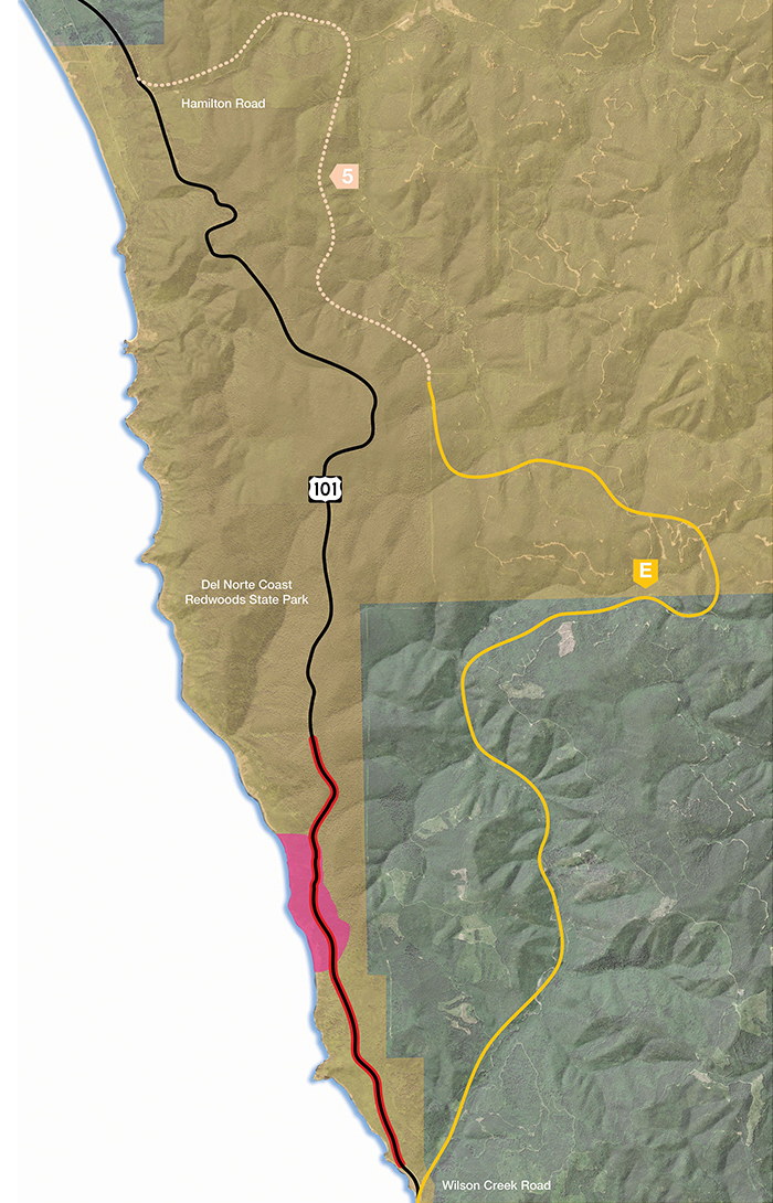
Each alternative is denoted with a letter, indicating one of the solid lines on the map; and a number, indicating one of the dotted lines.
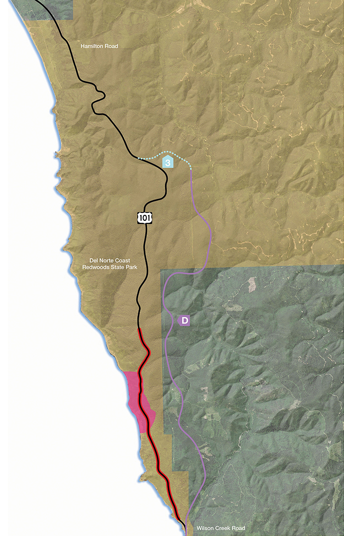
On the maps, the red line indicates the current Last Chance Grade alignment; the pink area indicates the landslide area.
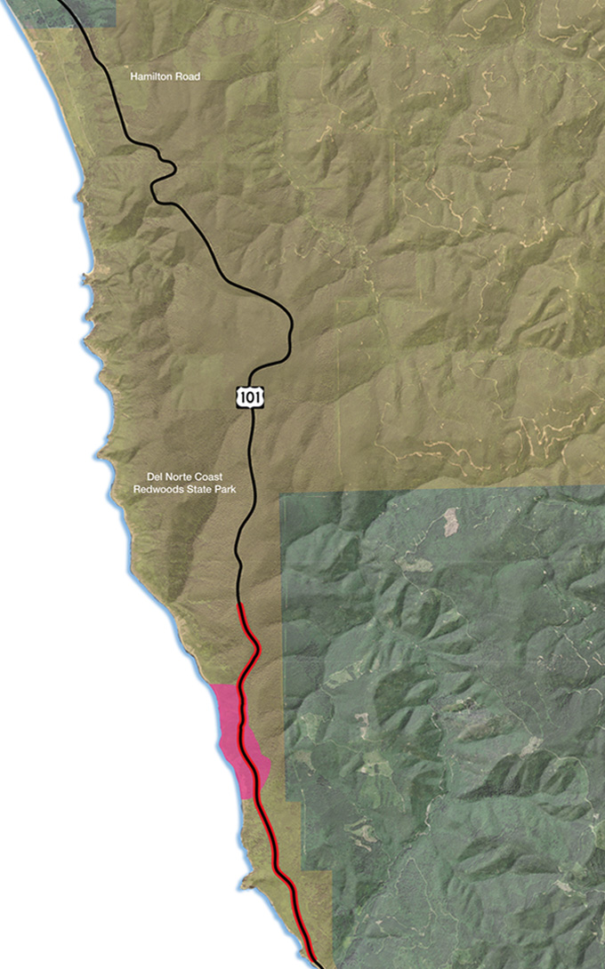
EA
Maintain Existing Alignment
This alternative will have no planned construction; US 101 will continue on its existing alignment. Regular maintenance and operations will continue, with emergency restoration projects as needed. Current annual maintenance costs of $2 million with a projected cost of approximately $26 million by 2034. Engineering solutions such as retaining walls have not been able to provide long-term stability, but will continue to be necessary to provide an adequate highway facility. As the landslide moves slowly, the road will require costly repairs and maintenance with potential environmental impacts including old-growth redwood impacts associated with minor retreats to keep the roadway open. A future slide might occur that is deep and large enough that it could result in a major failure of the roadway and complete closure of the roadway indefinitely. A major failure would have economic impacts and require a significant detour that is outlined in 9.2.3 Economic Impact Study. Some potential options closest to the existing alignment include a retreat upslope that could require taking more than 100 old-growth trees. For a more detailed explanation, please refer to page 15 of the Engineered Feasibility Study, available in the Document Library.
On the map, the red line indicates the current Last Chance Grade alignment and the pink area indicates the landslide area.
A1
Rudisill Road to LCG Tunnel
(Includes 2,000 foot tunnel)
Travel Time
(Wilson Creek Rd. to Hamilton Rd.)
Added Time: 1.0 min
New Construction
Length: 3.4 mi
Footprint: 77 acres
Schedule: 3 years
Cost (in Millions)
Minimum: $520M
Maximum: $710M
Existing Habitat Type
Coastal scrub/grassland /spruce: 7 acres
Riparian: 1 acre
Clear cut: 13 acres
Young Redwood Forest: 54 acres
Mature Redwood Forest: 0 acres
Old Growth Redwood Forest: 1 acre
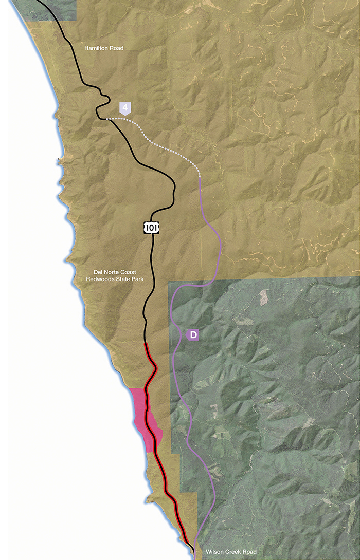
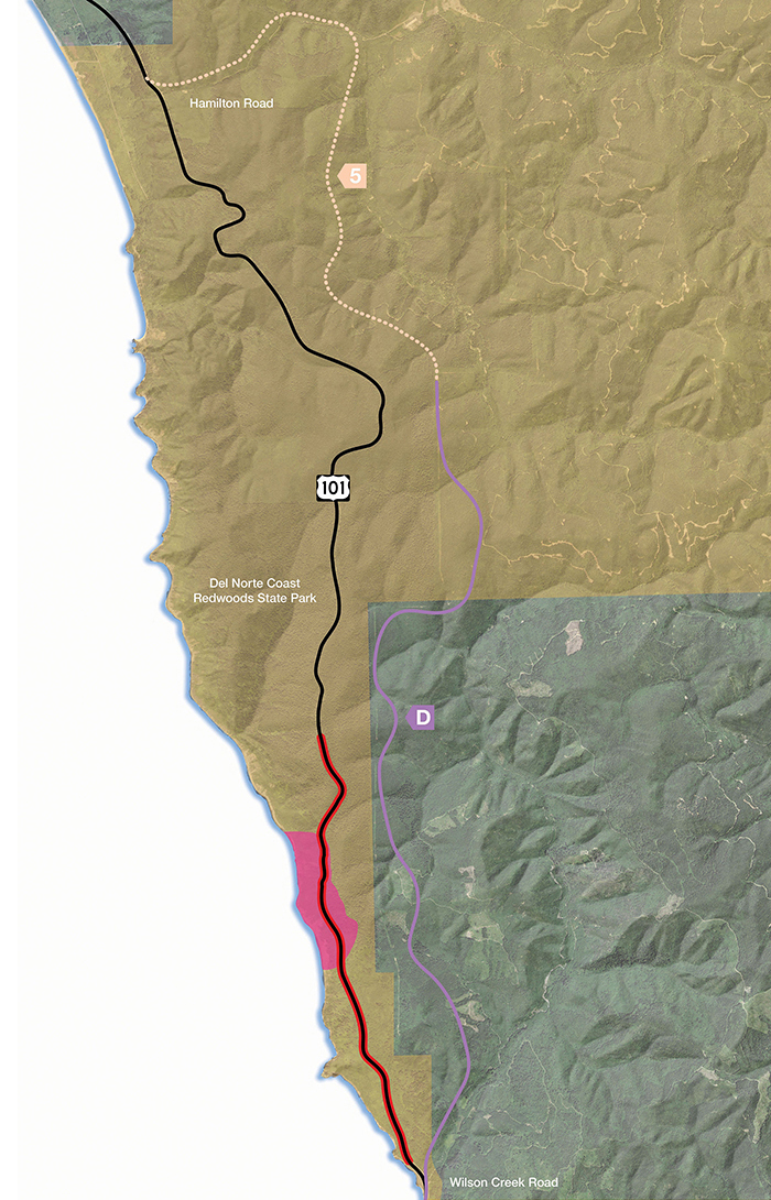
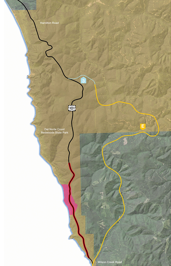
On the map, the alternative is denoted with a letter and a number, if the alternative has multiple segment options. The red line indicates the current Last Chance Grade alignment and the pink area indicates the landslide area.
Please note the following:
- Lines on the map indicate the width of each corridor, not the exact placement of the roadway.
- The acreages of “Existing Habitat Type” are estimates based on overall analyses of habitat types in the area.
- Costs are estimated and include construction, materials disposal and mitigation.
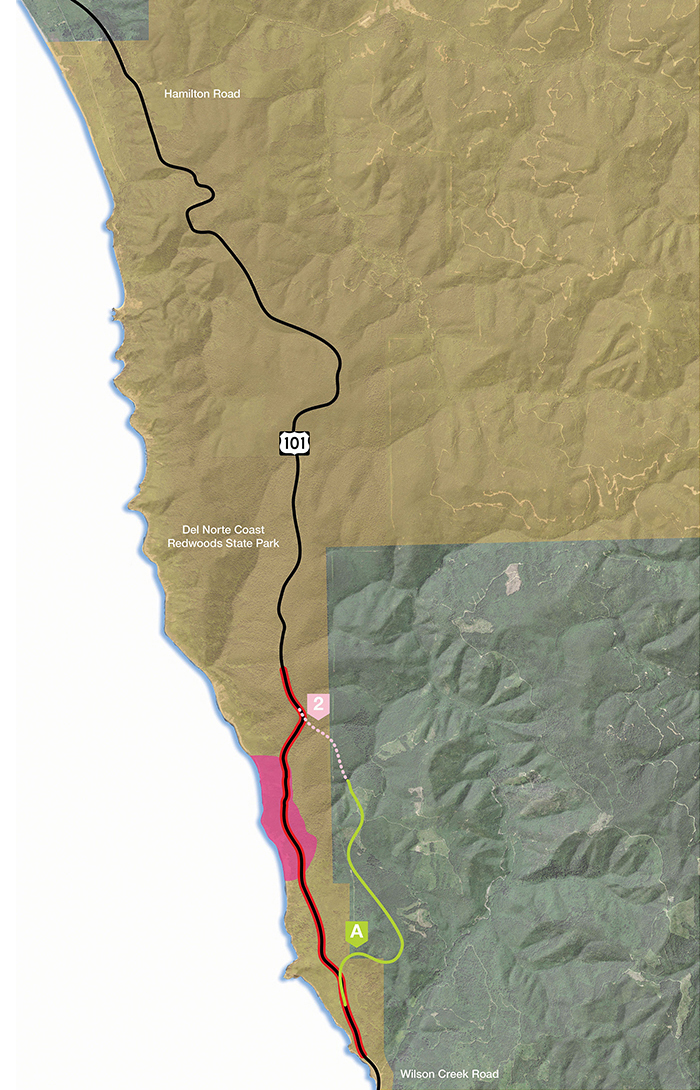
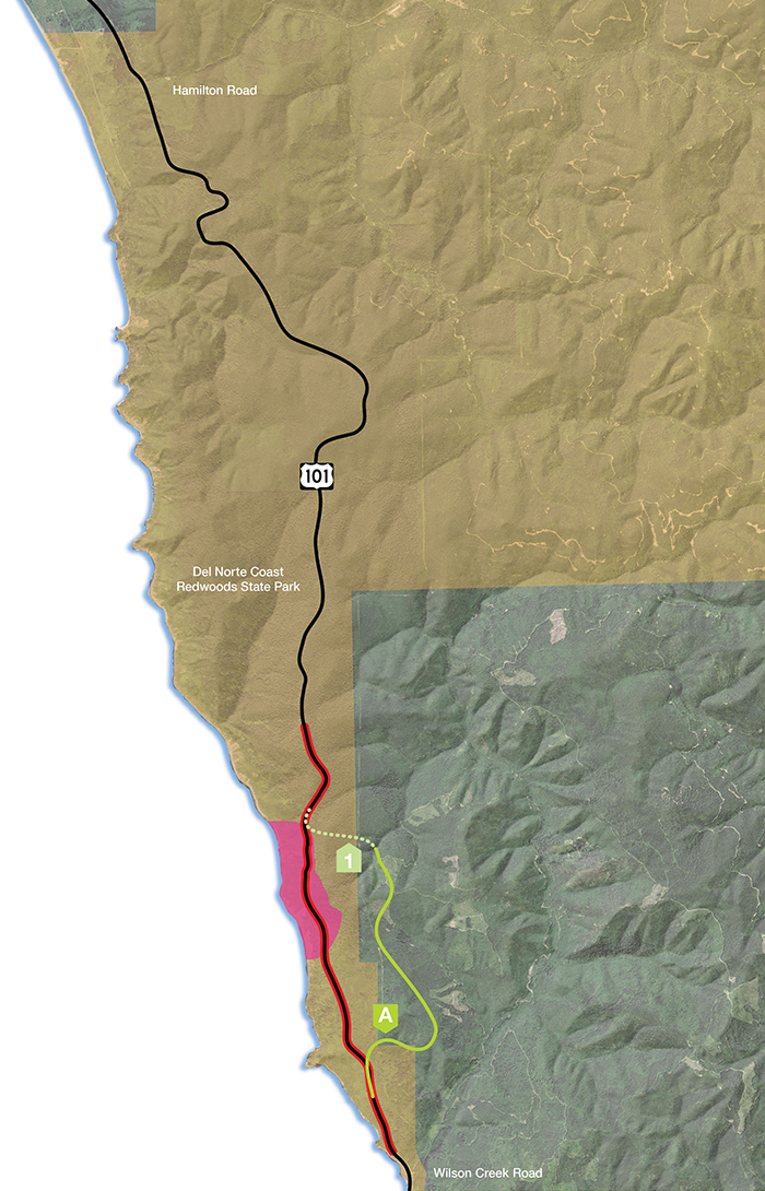
A2
Rudisill Road to Damnation Trailhead
Travel Time
(Wilson Creek Rd. to Hamilton Rd.)
Added Time: 0.8 min
New Construction
Length: 3.5 mi
Footprint: 80 acres
Schedule: 2 years
Cost (in Millions)
Minimum: $320M
Maximum: $380M
Existing Habitat Type
Coastal scrub/grassland /spruce: 7 acres
Riparian: 1 acre
Clear cut: 13 acres
Young Redwood Forest: 56 acres
Mature Redwood Forest: 0 acres
Old Growth Redwood Forest: 3 acres
On the map, the alternative is denoted with a letter and a number, if the alternative has multiple segment options. The red line indicates the current Last Chance Grade alignment and the pink area indicates the landslide area.
Please note the following:
- Lines on the map indicate the width of each corridor, not the exact placement of the roadway.
- The acreages of “Existing Habitat Type” are estimates based on overall analyses of habitat types in the area.
- Costs are estimated and include construction, materials disposal and mitigation.

B1
Wilson Creek Bridge to LCG Hill Tunnel
BASIS FOR ALTERNATIVE EXCLUSION
The criteria used for alternative exclusion includes geotechnical, environmental, engineering, and planning as a baseline used to evaluate alternatives. For this Feasibility Study, the primary impacts to avoid are natural resources and cultural landscape. An essential question answered in this process is whether an alternative provides a unique advantage over other alternatives being proposed. For a more detailed explanation, please refer to page 28 of the Engineered Feasibility Study, available in the Document Library.
(Includes 2,000 foot tunnel)
Travel Time
(Wilson Creek Rd. to Hamilton Rd.)
Added Time: 0.4 min
New Construction
Length: 3.7 mi
Footprint: 89 acres
Schedule: 3 years
Cost (in Millions)
Minimum: $550M
Maximum: $730M
Existing Habitat Type
Coastal scrub/grassland /spruce: 12 acres
Riparian: 1 acre
Clear cut: 10 acres
Young Redwood Forest: 65 acres
Mature Redwood Forest: 0 acres
Old Growth Redwood Forest: 1 acre
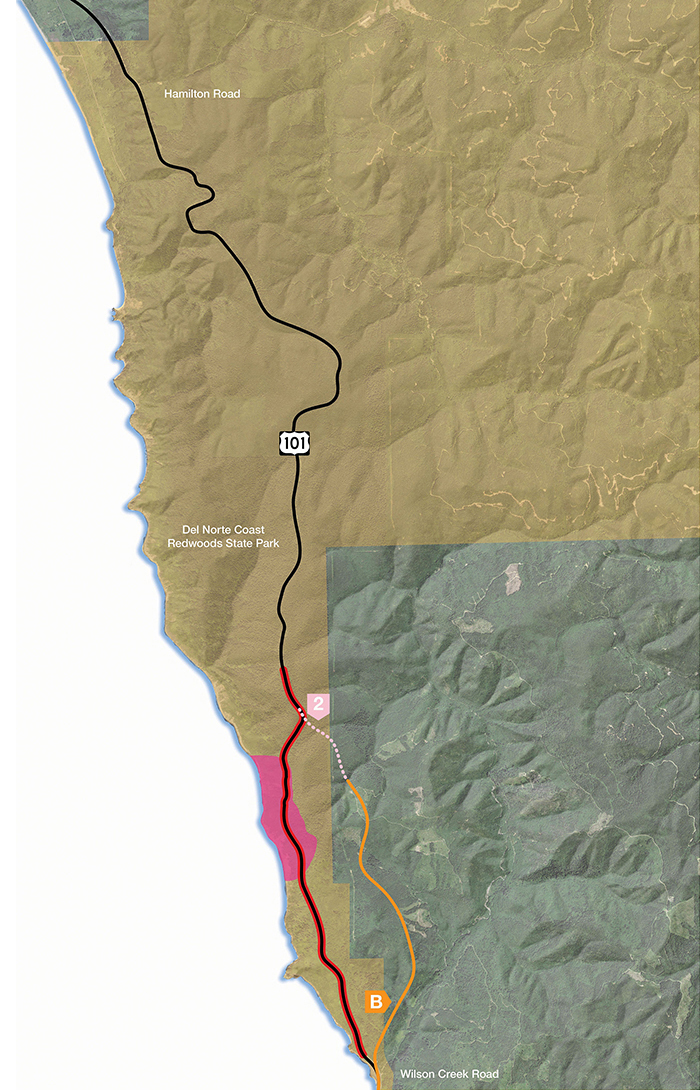
B2
Wilson Creek Bridge to Damnation Trailhead
BASIS FOR ALTERNATIVE EXCLUSION
The criteria used for alternative exclusion includes geotechnical, environmental, engineering, and planning as a baseline used to evaluate alternatives. For this Feasibility Study, the primary impacts to avoid are natural resources and cultural landscape. An essential question answered in this process is whether an alternative provides a unique advantage over other alternatives being proposed. For a more detailed explanation, please refer to page 28 of the Engineered Feasibility Study, available in the Document Library.
Travel Time
(Wilson Creek Rd. to Hamilton Rd.)
Added Time: 0.2 min
New Construction
Length: 3.7 mi
Footprint: 92 acres
Schedule: 2 years
Cost (in Millions)
Minimum: $340M
Maximum: $400M
Existing Habitat Type
Coastal scrub/grassland /spruce: 12 acres
Riparian: 1 acre
Clear cut: 10 acres
Young Redwood Forest: 67 acres
Mature Redwood Forest: 0 acres
Old Growth Redwood Forest: 3 acres
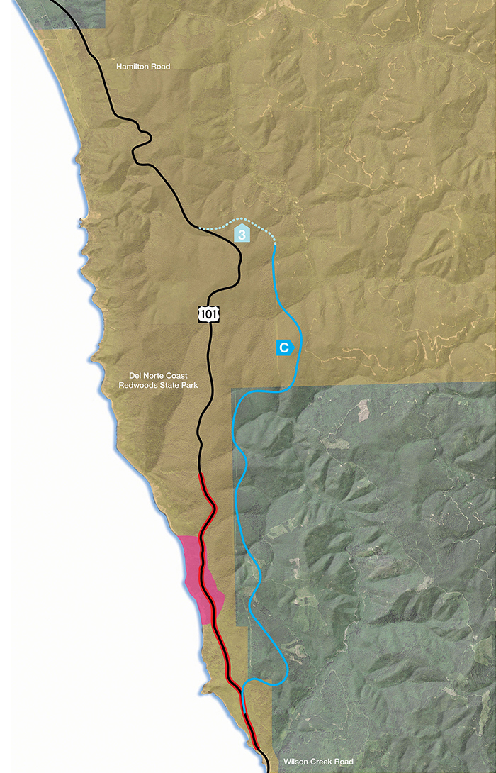
C3
Rudisill Road to South of Mill Creek Access
Travel Time
(Wilson Creek Rd. to Hamilton Rd.)
Added Time: 1.7 min
New Construction
Length: 8.2 mi
Footprint: 250 acres
Schedule: 3 years
Cost (in Millions)
Minimum: $750M
Maximum: $870M
Existing Habitat Type
Coastal scrub/grassland /spruce: 7 acres
Riparian: 1 acre
Clear cut: 13 acres
Young Redwood Forest: 205 acres
Mature Redwood Forest: 23 acres
Old Growth Redwood Forest: 0 acres
On the map, the alternative is denoted with a letter and a number, if the alternative has multiple segment options. The red line indicates the current Last Chance Grade alignment and the pink area indicates the landslide area.
Please note the following:
- Lines on the map indicate the width of each corridor, not the exact placement of the roadway.
- The acreages of “Existing Habitat Type” are estimates based on overall analyses of habitat types in the area.
- Costs are estimated and include construction, materials disposal and mitigation.
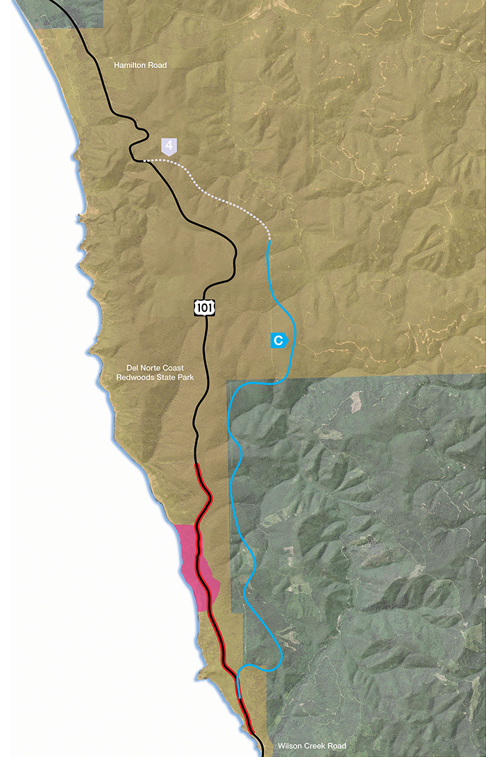
C4
Rudisill Road to North of Mill Creek Access
Travel Time
(Wilson Creek Rd. to Hamilton Rd.)
Added Time: 1.5 min
New Construction
Length: 9.0 mi
Footprint: 270 acres
Schedule: 4 years
Cost (in Millions)
Minimum: $820M
Maximum: $950M
Existing Habitat Type
Coastal scrub/grassland /spruce: 7 acres
Riparian: 1 acre
Clear cut: 13 acres
Young Redwood Forest: 205 acres
Mature Redwood Forest: 43 acres
Old Growth Redwood Forest: 0 acres
On the map, the alternative is denoted with a letter and a number, if the alternative has multiple segment options. The red line indicates the current Last Chance Grade alignment and the pink area indicates the landslide area.
Please note the following:
- Lines on the map indicate the width of each corridor, not the exact placement of the roadway.
- The acreages of “Existing Habitat Type” are estimates based on overall analyses of habitat types in the area.
- Costs are estimated and include construction, materials disposal and mitigation.
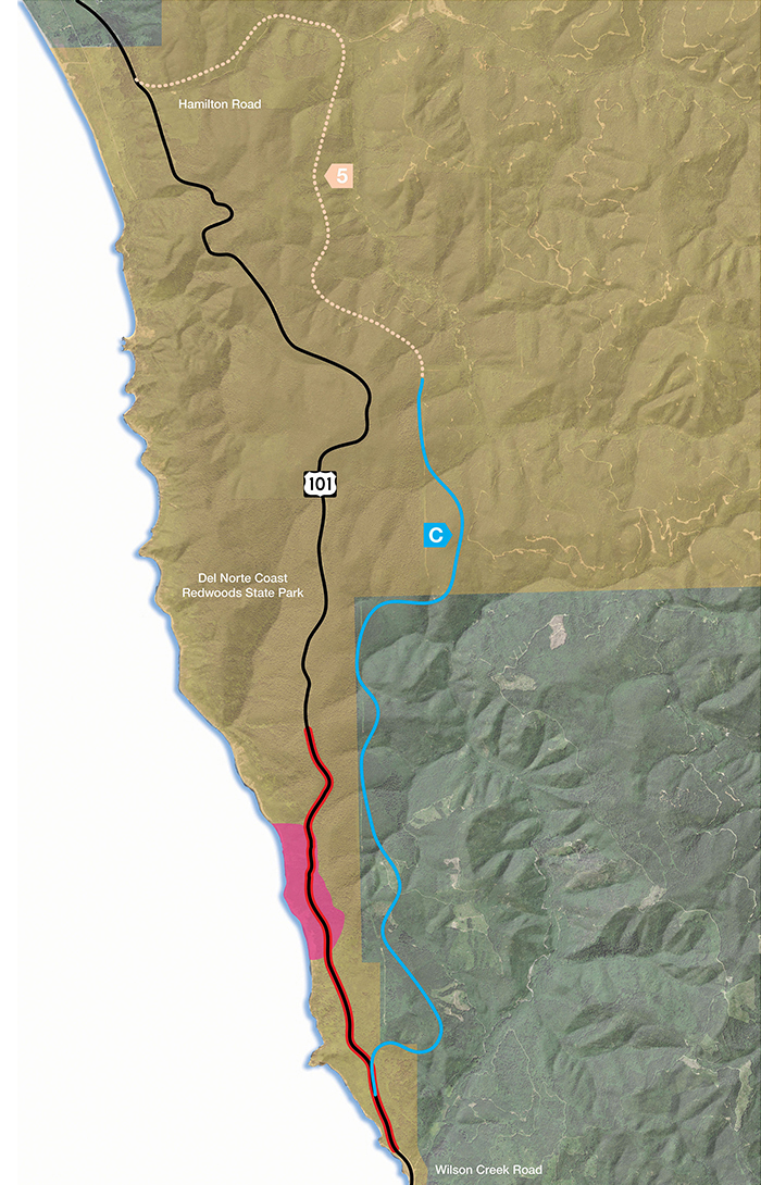
C5
Rudisill Road to Hamilton Road
Travel Time
(Wilson Creek Rd. to Hamilton Rd.)
Added Time: 2.6 min
New Construction
Length: 12.2 mi
Footprint: 332 acres
Schedule: 4 years
Cost (in Millions)
Minimum: $1,200M
Maximum: $1,300M
Existing Habitat Type
Coastal scrub/grassland /spruce: 7 acres
Riparian: 1 acre
Clear cut: 13 acres
Young Redwood Forest: 217 acres
Mature Redwood Forest: 93 acres
Old Growth Redwood Forest: 0 acres
On the map, the alternative is denoted with a letter and a number, if the alternative has multiple segment options. The red line indicates the current Last Chance Grade alignment and the pink area indicates the landslide area.
Please note the following:
- Lines on the map indicate the width of each corridor, not the exact placement of the roadway.
- The acreages of “Existing Habitat Type” are estimates based on overall analyses of habitat types in the area.
- Costs are estimated and include construction, materials disposal and mitigation.
D3
Wilson Creek Bridge to South of Mill Creek Access
BASIS FOR ALTERNATIVE EXCLUSION
The criteria used for alternative exclusion includes geotechnical, environmental, engineering, and planning as a baseline used to evaluate alternatives. For this Feasibility Study, the primary impacts to avoid are natural resources and cultural landscape. An essential question answered in this process is whether an alternative provides a unique advantage over other alternatives being proposed. For a more detailed explanation, please refer to page 28 of the Engineered Feasibility Study, available in the Document Library.
Travel Time
(Wilson Creek Rd. to Hamilton Rd.)
Added Time: 1.2 min
New Construction
Length: 8.4 mi
Footprint: 262 acres
Schedule: 3 years
Cost (in Millions)
Minimum: $770M
Maximum: $900M
Existing Habitat Type
Coastal scrub/grassland /spruce: 12 acres
Riparian: 1 acre
Clear cut: 10 acres
Young Redwood Forest: 216 acres
Mature Redwood Forest: 23 acres
Old Growth Redwood Forest: 0 acres
D4
Wilson Creek Bridge to North of Mill Creek Access
BASIS FOR ALTERNATIVE EXCLUSION
The criteria used for alternative exclusion includes geotechnical, environmental, engineering, and planning as a baseline used to evaluate alternatives. For this Feasibility Study, the primary impacts to avoid are natural resources and cultural landscape. An essential question answered in this process is whether an alternative provides a unique advantage over other alternatives being proposed. For a more detailed explanation, please refer to page 28 of the Engineered Feasibility Study, available in the Document Library.
Travel Time
(Wilson Creek Rd. to Hamilton Rd.)
Added Time: 1.0 min
New Construction
Length: 9.3 mi
Footprint: 282 acres
Schedule: 4 years
Cost (in Millions)
Minimum: $840M
Maximum: $980M
Existing Habitat Type
Coastal scrub/grassland /spruce: 12 acres
Riparian: 1 acre
Clear cut: 10 acres
Young Redwood Forest: 216 acres
Mature Redwood Forest: 43 acres
Old Growth Redwood Forest: 0 acres
D5
Wilson Creek Bridge to Hamilton Road
BASIS FOR ALTERNATIVE EXCLUSION
The criteria used for alternative exclusion includes geotechnical, environmental, engineering, and planning as a baseline used to evaluate alternatives. For this Feasibility Study, the primary impacts to avoid are natural resources and cultural landscape. An essential question answered in this process is whether an alternative provides a unique advantage over other alternatives being proposed. For a more detailed explanation, please refer to page 28 of the Engineered Feasibility Study, available in the Document Library.
Travel Time
(Wilson Creek Rd. to Hamilton Rd.)
Added Time: 2.0 min
New Construction
Length: 12.5 mi
Footprint: 344 acres
Schedule: 4 years
Cost (in Millions)
Minimum: $1,130M
Maximum: $1,320M
Existing Habitat Type
Coastal scrub/grassland /spruce: 12 acres
Riparian: 1 acre
Clear cut: 10 acres
Young Redwood Forest: 228 acres
Mature Redwood Forest: 93 acres
Old Growth Redwood Forest: 0 acres
E3
Wilson Creek Road to South of Mill Creek Access
BASIS FOR ALTERNATIVE EXCLUSION
The criteria used for alternative exclusion includes geotechnical, environmental, engineering, and planning as a baseline used to evaluate alternatives. For this Feasibility Study, the primary impacts to avoid are natural resources and cultural landscape. An essential question answered in this process is whether an alternative provides a unique advantage over other alternatives being proposed. For a more detailed explanation, please refer to page 28 of the Engineered Feasibility Study, available in the Document Library.
Travel Time
(Wilson Creek Rd. to Hamilton Rd.)
Added Time: 4.1 min
New Construction
Length: 11.4 mi
Footprint: 299 acres
Schedule: 4 years
Cost (in Millions)
Minimum: $1,020M
Maximum: $1,200M
Existing Habitat Type
Coastal scrub/grassland /spruce: 0 acres
Riparian: 22 acres
Clear cut: 0 acres
Young Redwood Forest: 254 acres
Mature Redwood Forest: 23 acres
Old Growth Redwood Forest: 0 acres
E4
Wilson Creek Road to North of Mill Creek Access
BASIS FOR ALTERNATIVE EXCLUSION
The criteria used for alternative exclusion includes geotechnical, environmental, engineering, and planning as a baseline used to evaluate alternatives. For this Feasibility Study, the primary impacts to avoid are natural resources and cultural landscape. An essential question answered in this process is whether an alternative provides a unique advantage over other alternatives being proposed. For a more detailed explanation, please refer to page 28 of the Engineered Feasibility Study, available in the Document Library.
Travel Time
(Wilson Creek Rd. to Hamilton Rd.)
Added Time: 3.9 min
New Construction
Length: 12.2 mi
Footprint: 319 acres
Schedule: 4 years
Cost (in Millions)
Minimum: $1,100M
Maximum: $1,280M
Existing Habitat Type
Coastal scrub/grassland /spruce: 0 acres
Riparian: 22 acres
Clear cut: 0 acres
Young Redwood Forest: 254 acres
Mature Redwood Forest: 43 acres
Old Growth Redwood Forest: 0 acres
E5
Wilson Creek Road to Hamilton Road
BASIS FOR ALTERNATIVE EXCLUSION
The criteria used for alternative exclusion includes geotechnical, environmental, engineering, and planning as a baseline used to evaluate alternatives. For this Feasibility Study, the primary impacts to avoid are natural resources and cultural landscape. An essential question answered in this process is whether an alternative provides a unique advantage over other alternatives being proposed. For a more detailed explanation, please refer to page 28 of the Engineered Feasibility Study, available in the Document Library.
Travel Time
(Wilson Creek Rd. to Hamilton Rd.)
Added Time: 5.0 min
New Construction
Length: 15.5 mi
Footprint: 381 acres
Schedule: 4 years
Cost (in Millions)
Minimum: $1,390M
Maximum: $1,620M
Existing Habitat Type
Coastal scrub/grassland /spruce: 0 acres
Riparian: 22 acres
Clear cut: 2 acres
Young Redwood Forest: 264 acres
Mature Redwood Forest: 93 acres
Old Growth Redwood Forest: 0 acres
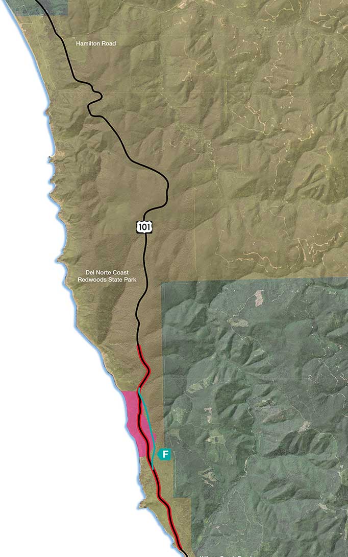
F
LCG Tunnel - Full Tunnel Parallel to E
(5,400 foot tunnel)
Travel Time
(Wilson Creek Rd. to Hamilton Rd.)
Added Time: 1.0 min
New Construction
Length: 1.3 mi
Footprint: 4 acres
Schedule: 6.5 years
Cost (in Millions)
Minimum: $690M
Maximum: $1,060M
Existing Habitat Type
Coastal scrub/grassland /spruce: 2 acres
Riparian: 0 acres
Clear cut: 0 acres
Young Redwood Forest: 0 acres
Mature Redwood Forest: 1 acre
Old Growth Redwood Forest: 1 acre
On the map, the alternative is denoted with a letter and a number, if the alternative has multiple segment options. The red line indicates the current Last Chance Grade alignment and the pink area indicates the landslide area.
Please note the following:
- Lines on the map indicate the width of each corridor, not the exact placement of the roadway.
- The acreages of “Existing Habitat Type” are estimates based on overall analyses of habitat types in the area.
- Costs are estimated and include construction, materials disposal and mitigation.